Can we do a better job of predicting river floods in New England?

Share
A professor at Northeastern University hopes his team’s research will build lead time into warnings about river flooding in New England, such as the one that devastated Vermont this month.
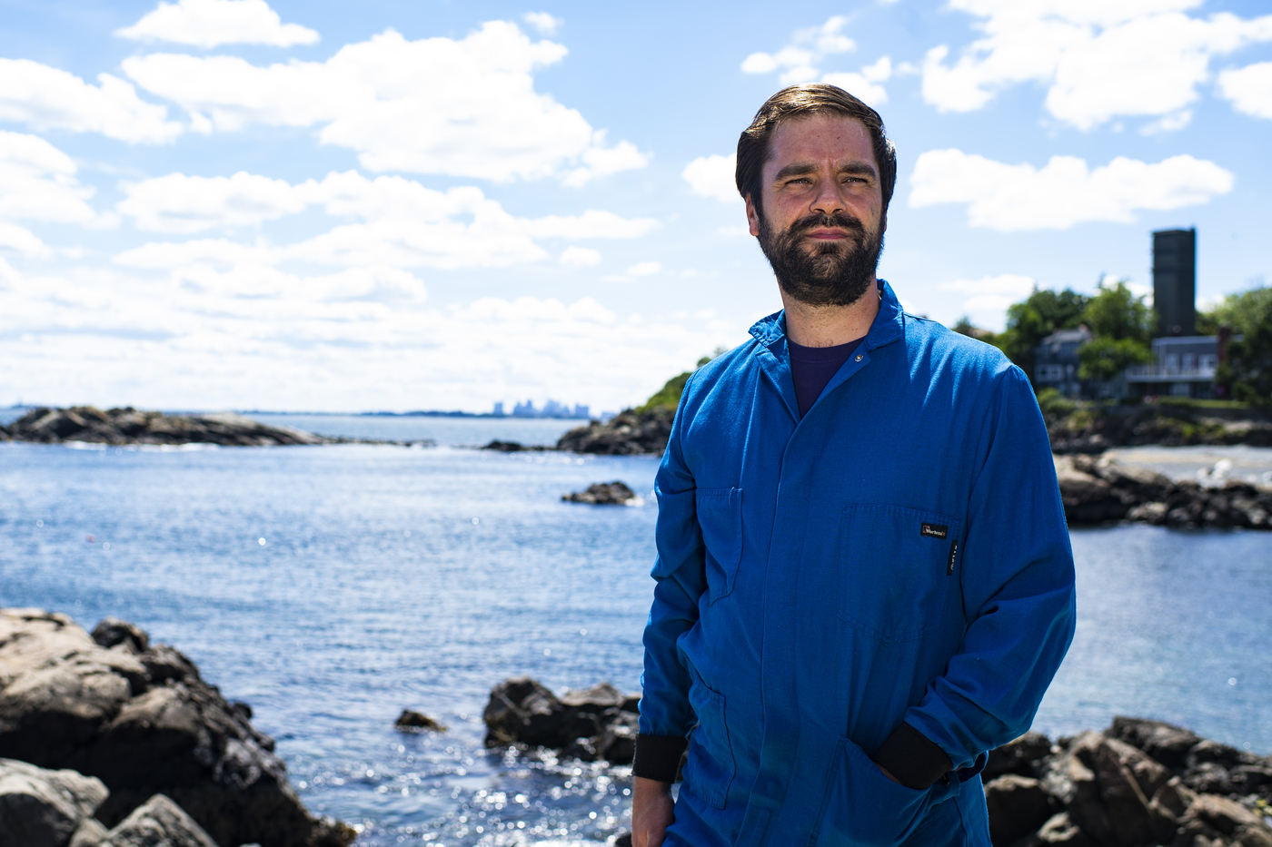
The stakes are high, says Samuel Munoz, an associate professor at Northeastern’s Coastal Sustainability Institute in Nahant, Massachusetts.
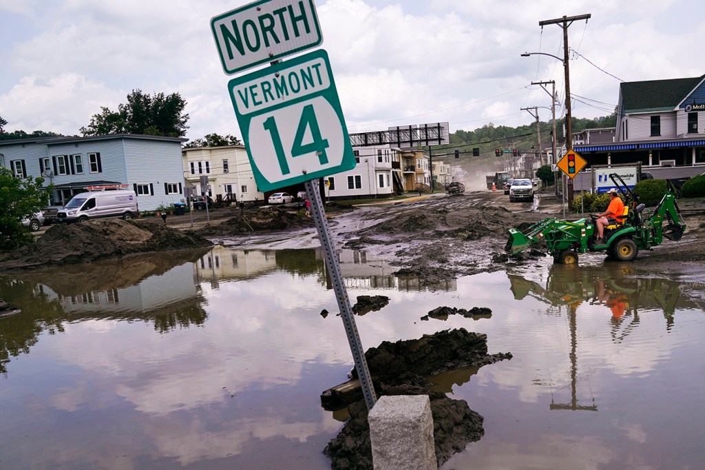
President Joe Biden declared Vermont a major disaster after July 7-12 floods washed out roads, damaged houses, businesses and farm fields and drowned a 63-year-old Barre man in his home.
Vermonters only had an advance warning of a day or two, Munoz says. “There was no sense of a high risk,” he says.
A grant from the Water Resources Research Center is funding a study by Munoz and Northeastern graduate student Lindsay Lawrence on understanding how climate change and variability are influencing river flooding in New England.
“We’re trying to look for signals” that could give managers and officials more time to prepare for flash and other floods by setting up road barriers, piling up sandbags or releasing water from dammed reservoirs in danger of overflowing, Munoz says.
The New England difference
He says New England differs from other parts of the country, where water temperatures and weather patterns from the Pacific Ocean—such as the currently active El Nino system—give scientists a sense of whether flooding risk will be high or low in a given year.
“It’s super useful (information),” says Munoz, whose paper showing that El Nino increases the risk of lower Mississippi River flooding was published in the journal Nature in 2017.
Developing a predictive model for New England presents additional challenges, because the states from Rhode Island to Maine do not appear to be directly affected by the atmospheric conditions related to El Nino, he says.
“It’s not as straightforward for New England,” Munoz says. El Nino’s “effect doesn’t seem to carry all the way across the continent” as far as flood prediction is concerned.
Better predictive tools
“People have studied floods and droughts in New England before, but a lot of the work was done in the 1990s,” before today’s more sophisticated imaging was available, Munoz says.
His team is using satellite imagery and remote sensing to collect data on atmospheric conditions relating to river flooding and plans to use AI and machine learning to discern patterns.
“We’re trying to apply new tools to come up with better answers,” Munoz says.
Researchers already know there are certain configurations of high and low atmospheric conditions that lead to heavy rainfall and the potential for flooding within a day or two.
“Now we’re trying to see who those tracks move over a week, two weeks or a month. Are there precursors that give us more lead time (to prepare)?” Munoz says.
“This is what (Lawrence) has been working on the last couple of weeks.”
Northeastern Global News, in your inbox.
Sign up for NGN’s daily newsletter for news, discovery and analysis from around the world.

Observatory on the Merrimack River
Munoz says he is seeking funding to extend the river study after his WRRC grant runs out in August.
In the meantime, he wants to use $700,000 he received as part of a National Science Foundation career award to set up a flood plain observatory along the Merrimack River in the area occupied by the New Hampshire Technological Institute.
The idea is to partner with the community college and its students on using sensors to measure water levels and collect sediment for sampling, Munoz says.
“They would come to Northeastern in the summer and do some work here,” he says. “There would be an exchange between the two institutions on research and education around rivers and floodplains and flooding management.”
Vermont floods provide valuable data
“Most floods in New England are caused by frontal lifting,” when warm, less dense air is forced to rise over cooler, denser air as a weather front advances, Munoz says.
As the air rises, it cools and condenses to form clouds and precipitation.
In the case of the Vermont floods, lots of precipitation—as much as nine inches of rain in two days.
In flatter areas, floodwaters can dispense with their energy by spreading out, Munoz says.
But in mountainous Vermont, floodwaters roared down the steep sides of watersheds in a rush toward roiling rivers, eroding soil, buckling roads and depositing tons of sediment along the way.
The historic deluge—comparable to Vermont’s flood of 1927—“is another data point we can use, and a pretty big one,” Munoz says.
“The whole focus (of the study) is on floods and mechanisms that cause them.”
Climate change
How much of Vermont’s July flooding, considered a one in 100 years event, can be attributed to climate change will undoubtedly be the subject of future studies, Munoz says.
“In a warmer world, we can expect more intense rainfall, which can lead to more devastating floods like the ones that we just saw in Vermont,” he says.
“Almost every summer for the rest of our lives is going to keep getting warmer and warmer. We can’t escape that,” Munoz says. “But we can certainly do things that build resilience.”
Cynthia McCormick Hibbert is a Northeastern Global News reporter. Email her at c.hibbert@northeastern.edu or contact her on Twitter @HibbertCynthia