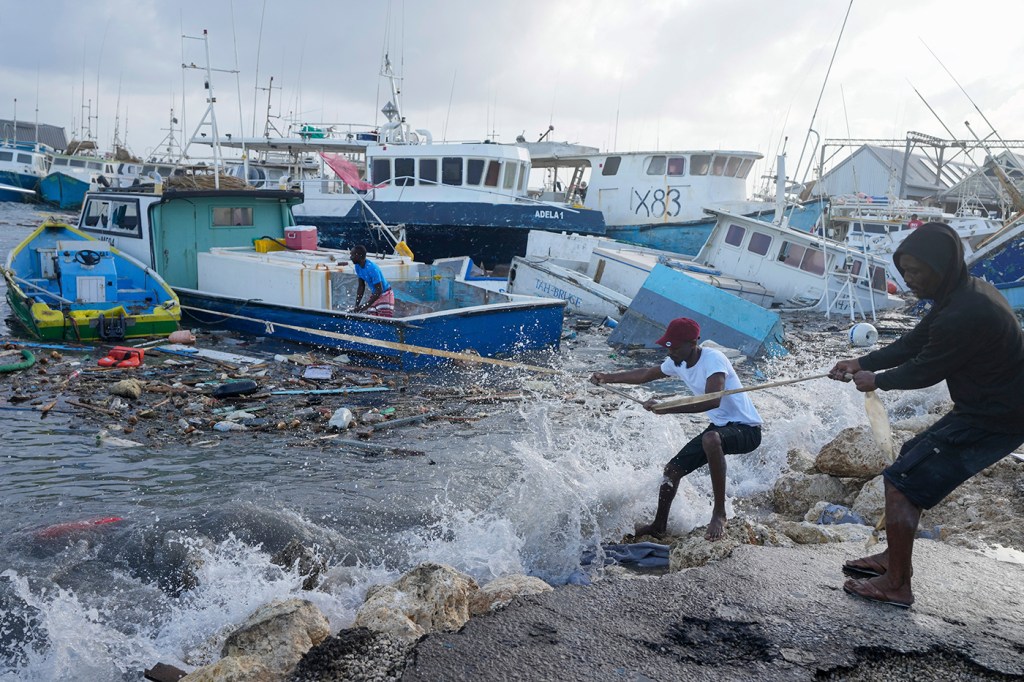
Why did Beryl develop into a record-setting hurricane? High ocean temps and other factors are to blame, Northeastern expert says
Jim Chen, a professor of civil and environmental engineering and marine and environmental sciences, expects a lot of strong hurricanes this year that will require preparation to mitigate impact.

A historic hurricane is rapidly making its way through the Caribbean Sea to the Gulf of Mexico.
Beryl turned into a Category 5 hurricane Monday night and is expected to strike Jamaica on Wednesday, according to the National Hurricane Service Center.
The early-season hurricane will likely bring heavy rainfall and flash flooding to the island as well as strong winds capable of causing devastating to catastrophic damage and loss of life.
“The peak [of the hurricane] season usually occurs in late August and September,” says Jim Chen, Northeastern University professor of civil and environmental engineering and marine and environmental sciences.
Beryl is the first Category 4 hurricane recorded in the month of June and the earliest Category 5 storm on record in the Atlantic Ocean hurricane season.
“Never has a hurricane with such power come early in July,” Che says.

Beryl ultimately is on the path to reach the Yucatan Peninsula of Mexico, Chen says, and could potentially affect Texas and Louisiana.
“Hurricanes like Hurricane Katrina, for example, even if they are 100 miles or 200 miles away, still, you feel the impact of wind and storm surge,” he says.
Northeastern Global News spoke to Chen about the causes of such a powerful storm, the likelihood of it making a downfall in the U.S. and long- and short-term preparation measures anyone can take.
His comments have been edited for brevity and clarity.
What were the factors that led to Hurricane Beryl?
There are a number of factors. If you look at the Caribbean Sea temperature this year, it is abnormal. The high seawater temperature provided the energy for the hurricane to strengthen to Category 5 in a short period of time.
You could associate high or abnormal sea temperature this year to global climate change. But I think, historically, we did have something like this [before]. For example, there were a lot of hurricanes during the 2005 hurricane season. Hurricane Katrina happened in 2005. But Beryl is unusual because it happened so early.
If you want to take 2005 as an example, it’s an indication that we’ll have a very busy hurricane season (as forecasted earlier this year), and then potentially we’ll have a lot of strong hurricanes later.
Featured Posts
Is there anything people or governments can do to make subsequent hurricane seasons less devastating?
Two things. One is that if you associate this one with climate change, then we need to reduce carbon emissions overall in the long term to keep the temperature from rising.
In the short term, knowing that a hurricane is coming, you need to mitigate the impact. That is to be aware that the hurricane is approaching, watch advisories issued by the local agencies and prepare for evacuation. If you cannot [evacuate], you need to move to a higher ground.
Hurricane shelters get established when you’re forecasting a hurricane making landfall on the Gulf Coast, for instance. Cities usually use big urban centers for shelters for citizens who cannot evacuate further inland. Those are the strong buildings designed as a hurricane shelter on higher ground.
Not every building can be a hurricane shelter — in 2005 in New Orleans, the Superdome, a football stadium, was used as a hurricane shelter. It was not designed as a hurricane shelter, and so the roof got ripped off and the field flooded.
What are the predictions for the East Coast in terms of impact
Based on the forecast so far, it looks like the hurricane is going to impact Jamaica and then go to the Gulf of Mexico. There’s uncertainty now whether it is going to move to the U.S. coastline in the gulf or stay on the straight path.
I don’t think it will move to the East Coast because of the weather pattern right now. Basically, there’s high [atmospheric] pressure, which, actually, overall, pushes and prevents the hurricane from moving toward the East Coast. Texas potentially can be impacted by a tropical storm or a Category 1 hurricane.
How can individuals prepare for a hurricane?
Preparation is possible, the earlier the better. To get ready before the hurricane season, get insurance, for example, for your house.
Prepare your evacuation plan if you live in a low-lying area. If you decide to stay (some people actually decide to stay) then you need to know where to stay. There is usually strong wind at the higher ground, but it’s safer in terms of flooding. Some people actually climbed to the attic [of their house] or on the rooftop during Hurricane Katrina. Obviously, it’s not the best plan.
Prepare food, medicine and water.


